September 1, 2026
Record Heat and Midweek Storms: Why Early September Is When Montgomery County Trees Fail
Maryland opened September 10–15 degrees above average with storms forecast for Wednesday night. Here is why early September is the worst setup of the year for tree failure in Rockville and Montgomery County — and the ten-minute check to do first.
Published by Rock Creek Tree, Turf & Landscape LLC — ISA Certified Arborists · Maryland Licensed Tree Expert #1944
Published September 1, 2026
It is in the low 90s in Rockville as this goes up, the heat index across Maryland is pushing past 100, and there are thunderstorms in the forecast for tonight with a stronger round Wednesday night. That combination — weeks of heat stress, then wind on soft ground, with the trees still in full leaf — is the most reliable way there is to put a tree on a roof in Montgomery County.
Here is what this week actually looks like, what August already did to the trees around here, and the ten-minute walk-around worth doing before Wednesday evening.
This Week's Forecast, in the Terms That Matter for a Tree
For our part of the county, the National Weather Service has highs in the lower 90s today with a slight chance of showers and thunderstorms, a 30 percent chance of storms tonight, and lows only falling into the low 70s.
- Wednesday: mostly sunny and hot, highs around 90, with a chance of showers and thunderstorms in the afternoon.
- Wednesday night: the strongest window of the week — a 50 percent chance of storms, with the evening carrying the best thunderstorm potential.
- Thursday: hot again, highs in the lower 90s.
- Friday through the weekend: gradually cooling into the upper and then lower 80s, with a scattered storm chance Friday.
Statewide, Maryland is opening September running 10 to 15 degrees above historical averages, with highs in the high 90s in some areas, heat index values above 100, and AccuWeather RealFeel readings as high as 110. Forecasters have hazardous heat expanding across the eastern half of the country by midweek, with severe thunderstorm potential running from the Great Lakes into the Mid-Atlantic.
Why Early September Is the Worst Setup of the Year for Trees
Most homeowners assume winter is when trees come down. It is not. Around here the worst stretch for whole-tree failure is the one we just started, and three things stack on top of each other to cause it.
1. The canopy is still full — maximum sail area
A mature oak or tulip poplar in early September is carrying a full season of leaves. Wind does not pass through that canopy, it pushes against it. The same 50-mile-an-hour gust that merely rattles a bare tree in January loads the entire crown like a sail in September and drives that force straight down into the trunk and the root plate. It is the reason September storms take whole trees while a stronger winter storm takes only limbs.
2. The trees are already stressed from the heat
Weeks of 90-degree days force a tree to shut down and conserve. You see it as browning leaf margins, leaves dropping early from inside the canopy, or a thin, off-color crown. A heat-stressed tree has fewer reserves to seal wounds and wall off decay, so damage done this week goes deeper than the identical damage would in May.
3. The ground is soft
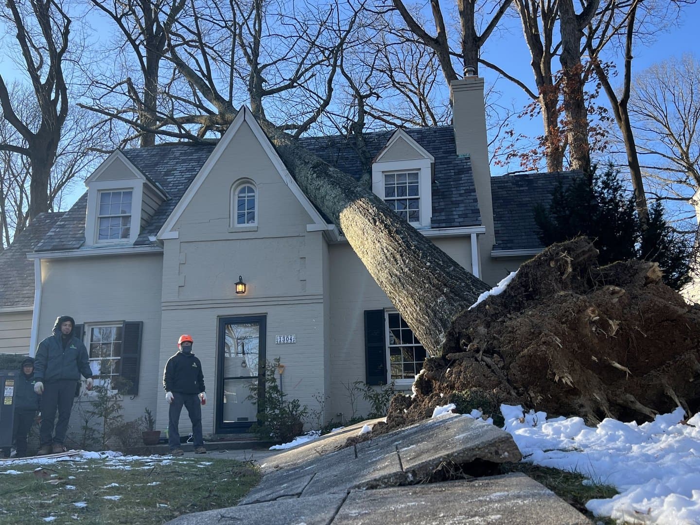
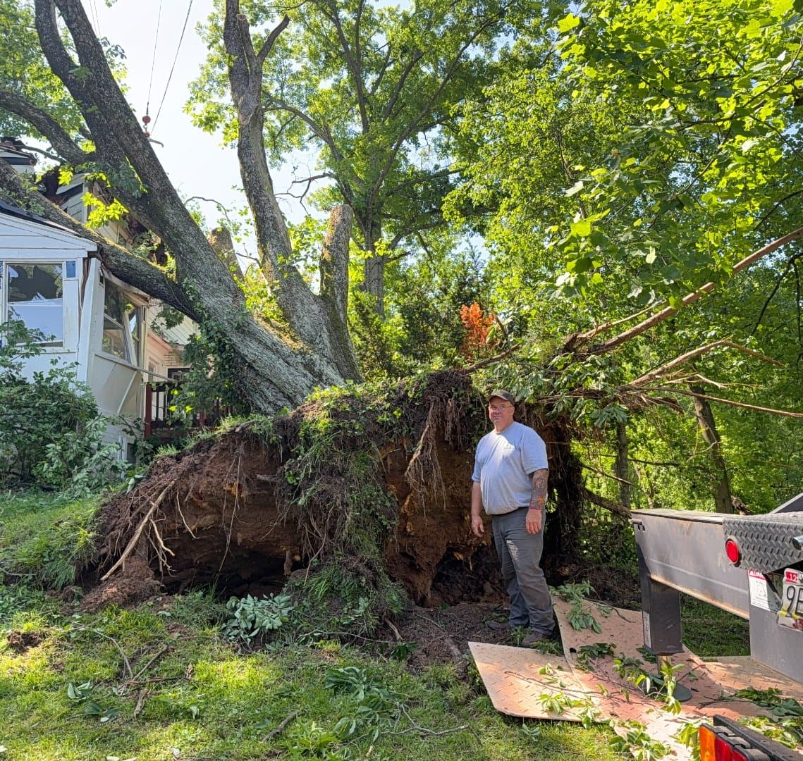
Montgomery County has taken round after round of storms this summer, and saturated soil does not grip a root plate. That is the mechanism behind an uprooted tree — not the trunk breaking, but the whole root mass rotating up out of wet ground. Add a full canopy and a 50 mph gust and the tree does not have to be sick to fail.
August Was the Preview, and It Was All Trees
None of this is theoretical. Look at what actually put Montgomery County neighborhoods in the dark last month:
- The weekend of August 1–2: severe storms moved through, and on the 6300 block of Avalon Drive in Bethesda downed limbs damaged a utility pole and wires, a transformer blew, and a tree caught fire. About 40 residents lost power. The National Weather Service had a flash flood warning up until roughly 7:45 p.m., and all three D.C.-area airports went to ground stops.
- August 10, around 4 p.m.: a storm knocked out power across Ashton and Sandy Spring. For residents there it was the third significant outage in roughly a month, and several ran two days or longer. BGE attributed the repeated outages to downed trees and limbs damaging poles and wires.
The pattern is worth sitting with. In nearly every one of these the thing that failed first was a tree, not the grid. Utilities clear the corridors they are responsible for, but the leaning tree in your side yard — the one over the service line that runs to your house — is yours.
Worth knowing before the next outage rather than during it: Montgomery County is split between two utilities. Pepco covers much of the county, including the Bethesda and Olney areas, while BGE serves the Ashton and Sandy Spring side. Find out which one you are on now, not at 9 p.m. in the dark.
What About the Tropics? The Honest Answer
September 10 is the climatological peak of the Atlantic hurricane season, so it is a fair question this week. As of Tuesday afternoon the National Hurricane Center is tracking Tropical Storm Edouard over the northwestern Gulf and expects no new tropical cyclone formation anywhere in the basin over the next seven days. Nothing is pointed at Maryland right now.
For the season overall, NOAA is holding its call for below-normal Atlantic activity — 7 to 13 named storms, 2 to 6 of them hurricanes, and 0 to 2 major hurricanes — with El Niño expected to develop. Historically, the odds of any tropical system passing within 50 miles of Maryland in a given year run around 22 percent, and about 7 percent for a hurricane.
Here is the part that gets missed. A below-normal hurricane season is not a quiet season for trees in Montgomery County. Almost none of the tree damage we clean up here comes from a landfalling hurricane. It comes from exactly what is sitting in this week's forecast — an ordinary summer thunderstorm with a 50 or 60 mph gust, hitting a tree that was already compromised. Do not let a seasonal outlook talk you out of dealing with a specific tree you are worried about.
The Ten-Minute Walk-Around to Do Before Wednesday Night
Do this in daylight, from the ground, before the next round comes through. You are not diagnosing anything. You are looking for the handful of signs that mean call somebody.
- Look up first. Broken limbs from the August storms are still lodged in canopies all over the county, and a hung limb can come down in dead calm.
- A new lean. Compare against an old photo or a fixed reference like a fence line. A trunk that has shifted even a few degrees since spring is urgent, not routine.
- Cracked or heaved soil at the base. If the ground on one side of the trunk is buckled, lifted, or pulling away, the root plate is already moving.
- Mushrooms or shelf-like conks at the base or on the trunk. Fruiting bodies mean decay is well established inside, and the outside of the trunk can still look perfectly sound.
- Browning or leaf drop concentrated on one limb or one side. Heat stress is usually even across the crown; damage isolated to a single limb usually means that limb is dying.
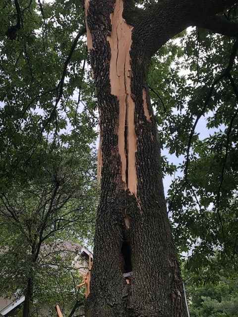
- A tight V-shaped fork on a big double trunk, especially with a seam or a dark line running down from it. Those unions split under wind load.
- Anything overhanging the driveway, a bedroom, the deck, or the power drop to the house. Position is what turns a tree problem into an insurance claim.
What Not to Do This Week
- Do not go near a tree or limb touching a wire. Assume every downed line is live, call 911, and report it to your utility.
- Do not do heavy pruning in a heat wave. Trees are already conserving, and big cuts now add stress and invite pests. Routine pruning can wait for cooler weather. Hazards cannot.
- Do not run a chainsaw overhead or off a ladder. Storm-damaged wood holds stored tension and releases without warning.
- Do not hire the truck that pulls into your driveway after a storm without checking it out. Ask for a Maryland Licensed Tree Expert number and a certificate of insurance before anyone touches a tree. Out-of-area crews work Montgomery County neighborhoods after every big storm.
If Something Is Already Damaged
Call for emergency service right away if a tree or large limb is on your house, garage, car, or driveway; if a tree is leaning over a structure or blocking access; if a limb is hanging over a walkway or play area; or if soil is lifting at the base of any tree near where people go.
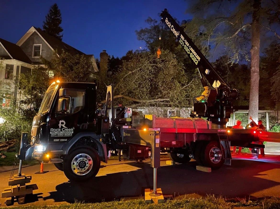
Rock Creek Tree, Turf & Landscape runs 24/7 emergency tree removal across Rockville, Olney, Bethesda and the rest of Montgomery County. We are ISA Certified Arborists, Maryland Licensed Tree Expert #1944 and MHIC licensed, fully insured, with crane services for removals too large or too close to a structure to take down conventionally. Our crews are based here at 17520 Bowie Mill Road in Rockville, not dispatched in from three states away after the fact.
If you are not sure whether the tree in your yard is a problem, this is the week to find out rather than the week after. Request a free quote and we will tell you plainly what genuinely needs to come down and what can be saved.
For an active emergency — a tree on a structure or blocking access — call 301-580-6023 any hour.